
KNUTFORDIANS got a glimpse of ‘Knutsford from above’ last week – and this week we can look a little closer at how the town centre has changed over the past 90 years.
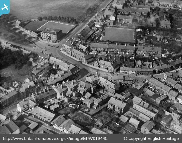
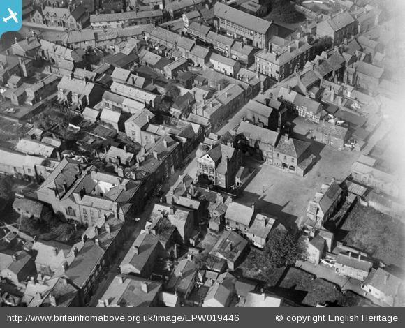
Rewind back to 1927, and Princess Street, Canute Place and King Street are somewhat different to how we know them today.
The first image shows the junction of Tatton Street, Princess Street and Canute Place, and some familiar sites remain, such as the White Bear and the Red Cow (now the Old Sessions House).
The second image shows the heart of the town, King Street, and its street-face conceals the mish-mash of buildings on either side.
The images are from a new website, britainfromabove.org.uk, which currently features 12 fascinating aerial photos of locations across the town, including the prison and court house, Brook Street, Drury Lane, the town centre, and Booths Hall.
Britain from Above website launched on June 25 and the collection is made up of thousands of photographs from locations across the UK, which all date from 1919-1953.
Users can download images, customise their own themed photo galleries, share personal memories and add information to enrich the understanding of the images.
They are also invited to identify the locations of a number of ‘mystery’ images that have left experts stumped.
Dr Peter Wakelin, secretary of the Royal Commission on the Ancient and Historical Monuments of Wales, who helped compile the collection, said: “People are always fascinated by views of familiar places from above, and in these you have added values of seeing those places through time too.
“We know people are hugely engaged by these kinds of images, and I’m sure they will soon be among the most popular in our collections.”


Comments: Our rules
We want our comments to be a lively and valuable part of our community - a place where readers can debate and engage with the most important local issues. The ability to comment on our stories is a privilege, not a right, however, and that privilege may be withdrawn if it is abused or misused.
Please report any comments that break our rules.
Read the rules here